

Advian to develop next-generation maritime fairway technologies in Finland, Sweden, and Spain
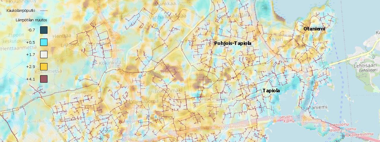
New alternatives are actively pursued in the detection of leaks in the district heating network. In a pilot project launched by Advian and Fortum, the location data of the existing district heating network is being combined with satellite data to detect possible leaks.
If the pilot is successful, in the future satellite images can be used in place of the thermal imaging done by helicopter, thereby eliminating the noise pollution residents in the area experience during the imaging.
The plan is to carry out the pilot project during May-June in the Espoo, Kauniainen and Kirkkonummi network areas. Satellites will be used to detect thermal differences on the ground surface; the differences can be detected with an accuracy of 0.1 degrees. The temperature of the supply water in district heating pipelines ranges between 75-110 °C, depending on the season. The pilot will determine the ability to detect possible pipe leaks from the images and to distinguish them from other heat sources, like buildings or cars.
“As district heating transitions to carbon-neutral and non-combustible heat production, we will also need digital solutions to support the transition. We are investing in automation, overall optimisation and demand response, but also in predictive maintenance. These kinds of pilots are important in the process. Our operations will change significantly in the years ahead,” says the smart energy systems lead Viki Kaasinen from Fortum’s Heating & Cooling business.
The goal of the pilot is to use satellite images to detect possible pipe leaks as cost-efficiently and quickly as possible compared to thermal imaging, which is done less frequently. Improved efficiency in detecting possible points of leakage improves the ability to ensure the reliable supply of district heating.
“We are actively monitoring new technologies, and we always want to bring to energy sector operators ideas that can help them respond to the sector’s transition and pursue carbon neutrality. Satellite imagery is a good example of emerging technologies and the use of external data as part of processes and operations. We are very pleased to be part of the ambitious pilot with an innovative and bold player,” says Laura Tuomikoski, Senior Advisor, Advian.
The pilot is a good example of how various data can be combined and used to create new solutions and more efficient operating models. The optimal benefit from the pilot can be achieved by combining the existing data sources with satellite imagery, analysing and processing the output data, and then using that data in predictive maintenance processes.

Would you like to hear more about our solutions for Utilities sector?
Let's have a chat - book a free online meeting with our expert below 👇


